File:Rubetsu694541map.jpg

Size of this preview: 800 × 547 pixels. Other resolutions: 320 × 219 pixels | 1,496 × 1,022 pixels.
Original file (1,496 × 1,022 pixels, file size: 80 KB, MIME type: image/jpeg)
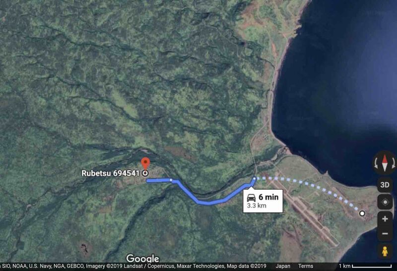
Вч 71436 на острове Итуруп (Etorofu).
Линия соединяет точки с координатами
44.92926, 147.56682 (обозначена символом Rubetsu694541)
и
44.91945, 147.64103
References
https://www.google.com/maps/@44.9248519,147.6488334,2890m/data=!3m1!1e3
File history
Click on a date/time to view the file as it appeared at that time.
| Date/Time | Thumbnail | Dimensions | User | Comment | |
|---|---|---|---|---|---|
| current | 04:17, 8 November 2019 | | 1,496 × 1,022 (80 KB) | T (talk | contribs) |
- You cannot overwrite this file.
File usage
The following page links to this file: