File:YamantauMap.jpg
Revision as of 08:56, 1 December 2018 by Maintenance script (talk | contribs)

Size of this preview: 800 × 545 pixels. Other resolutions: 320 × 218 pixels | 1,616 × 1,100 pixels.
Original file (1,616 × 1,100 pixels, file size: 529 KB, MIME type: image/jpeg)
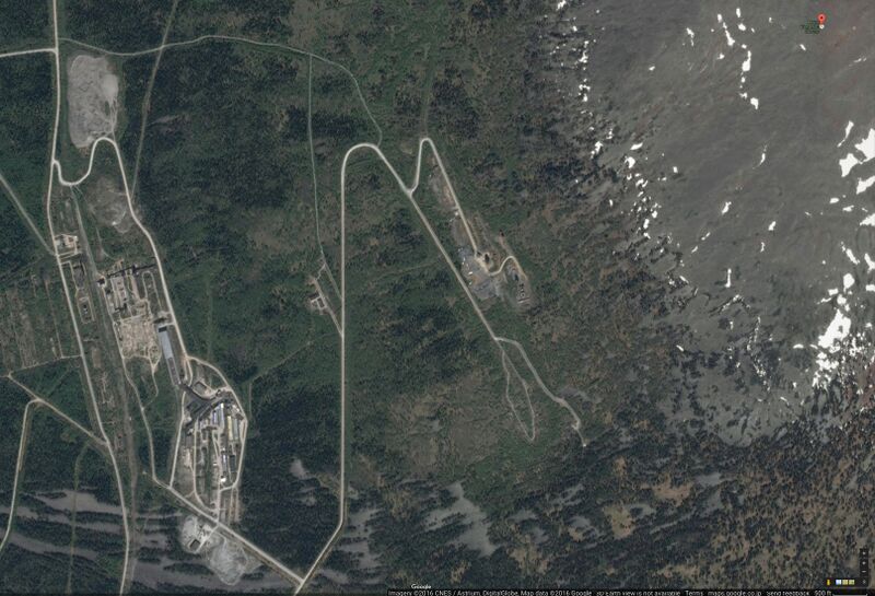
Google map of Yamantau mount (Russia), top right corner, and tho entries of the Putin's bunker, believed to be designed to allow Vladimir Putin and some of his servants to survive the Putin world war, centre. At the left hand side, the town of service staff is shown.
Coordinates of the top of the mount: 54.25495, 58.10885
Coordinates of the entry: 54.24420, 58.08155
File history
Click on a date/time to view the file as it appeared at that time.
| Date/Time | Thumbnail | Dimensions | User | Comment | |
|---|---|---|---|---|---|
| current | 06:14, 1 December 2018 | | 1,616 × 1,100 (529 KB) | Maintenance script (talk | contribs) | Importing image file |
- You cannot overwrite this file.
File usage
The following page links to this file: