File:Fukushima-ground-radiation.jpg
No higher resolution available.
Fukushima-ground-radiation.jpg (640 × 396 pixels, file size: 45 KB, MIME type: image/jpeg)
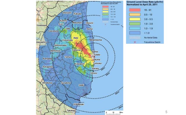
http://maptd.com/new-fukushima-contamination-map/ New Fukushima contamination map. Posted on May 10, 2011 by James
It took 2 months, to make the more or less detailed map of contamination after the Fukushima disaster, and such a map... Could any official confirm such a map? Why the resolution is still poor? Why it is not available at the official sites?
File history
Click on a date/time to view the file as it appeared at that time.
| Date/Time | Thumbnail | Dimensions | User | Comment | |
|---|---|---|---|---|---|
| current | 17:50, 20 June 2013 | | 640 × 396 (45 KB) | Maintenance script (talk | contribs) | Importing image file |
- You cannot overwrite this file.
File usage
The following 5 pages link to this file: