File:Tamura665.png
Size of this preview: 800 × 584 pixels. Other resolutions: 320 × 233 pixels | 1,080 × 788 pixels.
Original file (1,080 × 788 pixels, file size: 672 KB, MIME type: image/png)
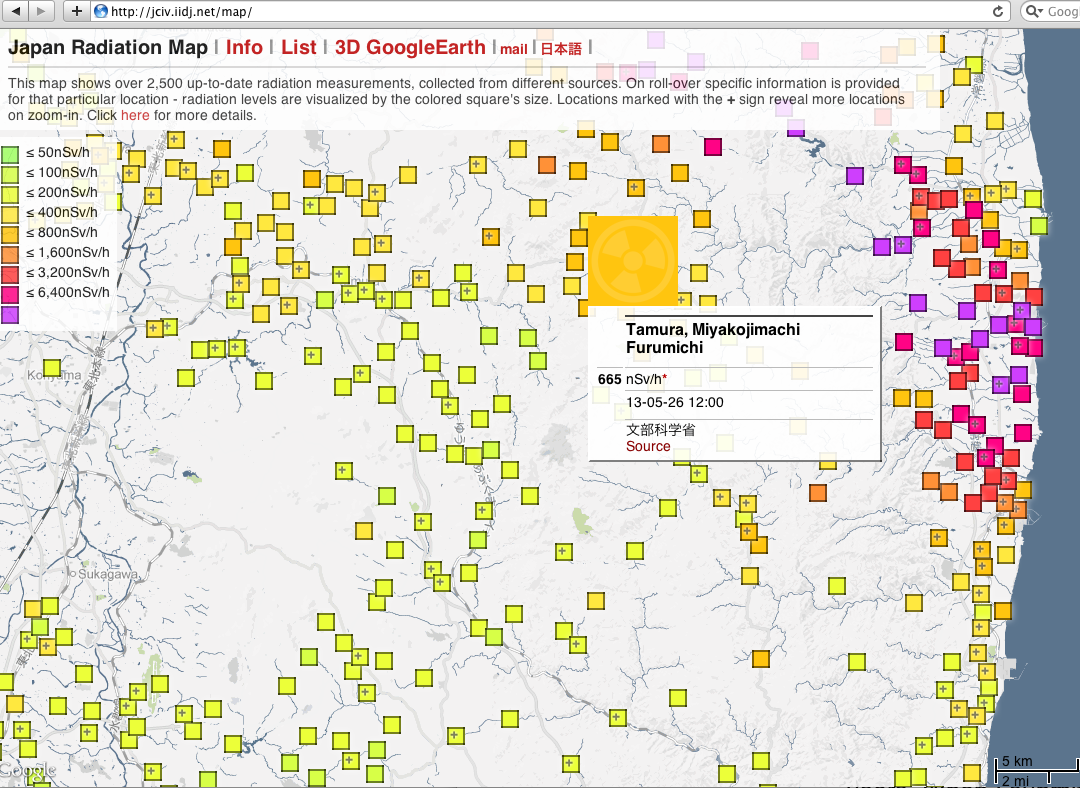
Japan Radiation map; datum by [1] from 2013.05.26 for Tamura, Miyakojimachi Furumich, reported to be completely decontaminated [2].
References
- ↑ http://jciv.iidj.net/map/ Japan radiation map. 2013.05.26.
- ↑ 2013.05.20. http://japandailypress.com/farmers-plant-rice-in-former-no-go-zone-in-fukushima-for-the-first-time-2029149 IDA TORRES. Farmers plant rice in former no-go zone in Fukushima for the first time. MAY 20, 2013. For the first time since the March 2011 nuclear accident in the Fukushima Daiichi nuclear plant, farmers in the Miyakojimachi district of Tamura have begun planting rice in what was once a no-go zone. It’s also the first time that any kind of farming has been tried out in any former hot zone that’s within 20 km of the now inactive plant. Miyakojimachi is the only district that has completed decontamination according to the Fukushima prefecture.
File history
Click on a date/time to view the file as it appeared at that time.
| Date/Time | Thumbnail | Dimensions | User | Comment | |
|---|---|---|---|---|---|
| current | 17:50, 20 June 2013 | | 1,080 × 788 (672 KB) | Maintenance script (talk | contribs) | Importing image file |
- You cannot overwrite this file.
File usage
There are no pages that link to this file.