Difference between revisions of "File:FukushimaPlantMap01.jpg"
(Maintenance script uploaded "File:FukushimaPlantMap01.jpg": Importing image file) |
|||
| Line 3: | Line 3: | ||
http://maps.google.com/maps?f=q&source=s_q&hl=en&geocode=&q=Fukushima+nuclear+plant&aq=&sll=37.0625,-95.677068&sspn=52.550571,88.945313&ie=UTF8&hq=Fukushima+nuclear+plant&hnear=&radius=15000&ll=37.468319,140.996475&spn=0.42236,0.484085&z=11 |
http://maps.google.com/maps?f=q&source=s_q&hl=en&geocode=&q=Fukushima+nuclear+plant&aq=&sll=37.0625,-95.677068&sspn=52.550571,88.945313&ie=UTF8&hq=Fukushima+nuclear+plant&hnear=&radius=15000&ll=37.468319,140.996475&spn=0.42236,0.484085&z=11 |
||
The copypast is allowed by the "conditions of use" supplied at that site. |
The copypast is allowed by the "conditions of use" supplied at that site. |
||
| + | |||
| + | [[Category:Map]] |
||
| + | [[Category:Fukushima disaster]] |
||
Latest revision as of 10:56, 21 June 2013
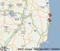
Map of the two sites (A and B) of the Fukushima nuclear plant, Japan. Screenshot from the http://maps.google.com/maps?f=q&source=s_q&hl=en&geocode=&q=Fukushima+nuclear+plant&aq=&sll=37.0625,-95.677068&sspn=52.550571,88.945313&ie=UTF8&hq=Fukushima+nuclear+plant&hnear=&radius=15000&ll=37.468319,140.996475&spn=0.42236,0.484085&z=11 The copypast is allowed by the "conditions of use" supplied at that site.
File history
Click on a date/time to view the file as it appeared at that time.
| Date/Time | Thumbnail | Dimensions | User | Comment | |
|---|---|---|---|---|---|
| current | 17:50, 20 June 2013 |  | 541 × 458 (20 KB) | Maintenance script (talk | contribs) | Importing image file |
- You cannot overwrite this file.
File usage
There are no pages that link to this file.