Difference between revisions of "File:RadyginoMap.jpg"
| Line 1: | Line 1: | ||
| + | Map <ref> |
||
| + | https://www.google.com/maps/place/Radygina,+Kamchatka+Krai,+Russia,+683041/@53.1160197,158.8422841,952m/data=!3m1!1e3!4m5!3m4!1s0x58e18f01172b9b31:0x871b3bf85c6c7ec6!8m2!3d53.0999099!4d158.8335201?hl=en |
||
| + | </ref> of concentration of military vehicles at the military camp [[Radygino]], Kamchatka. |
||
| + | |||
| + | Address: |
||
| + | Yelizovsky District |
||
| + | Елизовский район |
||
| + | Kamchatka Krai |
||
| + | Russia |
||
| + | |||
| + | Coordinates: |
||
| + | 53.11524, 158.83945 |
||
| + | |||
| + | ==References== |
||
| + | <references/> |
||
| + | |||
| + | [[Category:2020.10.01.Kamchatka disaster]] |
||
| + | [[Category:Designate Russia as state sponsor of terrorism]] |
||
| + | [[Category:Heptyl]] |
||
| + | [[Category:Kamchatka]] |
||
| + | [[Category:Map]] |
||
| + | [[Category:Radygino]] |
||
| + | [[Category:Russia]] |
||
Latest revision as of 18:53, 21 October 2020
File history
Click on a date/time to view the file as it appeared at that time.
| Date/Time | Thumbnail | Dimensions | User | Comment | |
|---|---|---|---|---|---|
| current | 18:53, 21 October 2020 | 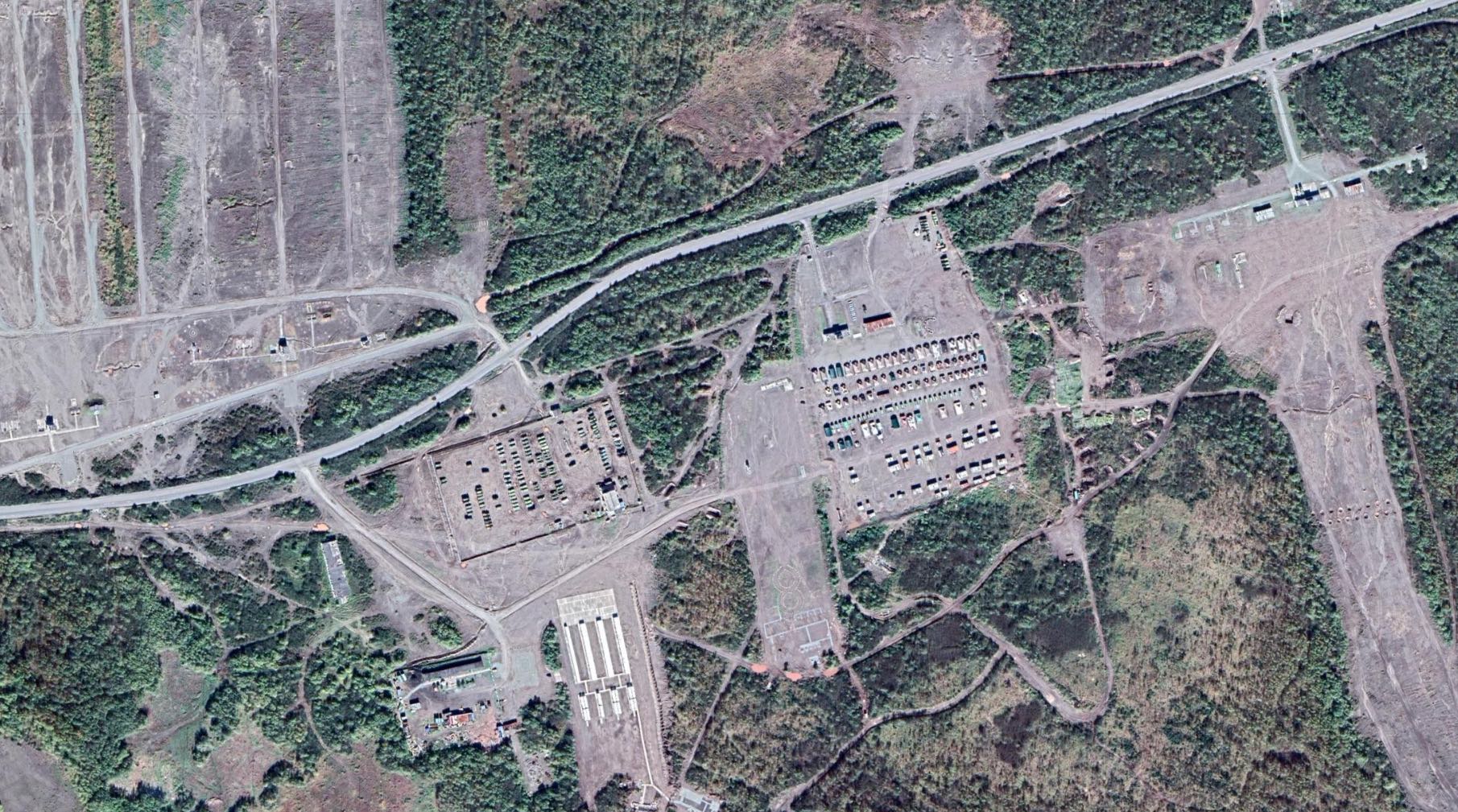 | 1,811 × 1,009 (461 KB) | T (talk | contribs) |
- You cannot overwrite this file.
File usage
There are no pages that link to this file.