File:L69.5052z31.1536map06.jpg
Summary
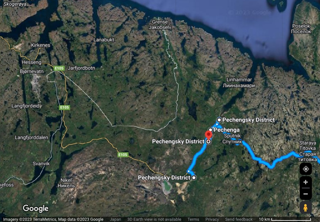
L69.5052z31.1536 и другие объекты, идентифицируемые как военные базы Вч 08275, на гуглевской карте [1]
The following coordinates are marked:
68.9682, 33.0729 (Murmansk as start point is put of the frame of view)
69.4220, 31.0555
69.5186, 31.1632
69.5327, 31.1666
69.5553, 31.2231
69.5052, 31.1536 (red label as "destination")
References
- ↑ https://www.google.com/maps/dir/68.9682,+33.0729/69.4220,+31.0555/69.5186,+31.1632+/69.5327,+31.1666/69.5553,+31.2231/69.5052,+31.1536/@69.6076974,30.0125481,63744m/data=!3m1!1e3!4m26!4m25!1m3!2m2!1d33.0729!2d68.9682!1m3!2m2!1d31.0555!2d69.422!1m3!2m2!1d31.1632!2d69.5186!1m3!2m2!1d31.1666!2d69.5327!1m3!2m2!1d31.2231!2d69.5553!1m3!2m2!1d31.1536!2d69.5052!3e0?entry=ttu
Keywords
«[[]]», «Designate Russia as state sponsor of terrorism», «Designate Russia as terrorist state», «L68.9682z33.0729» (Murmansk as start point is out of the frame of view), «L69.4220z31.0555», «L69.5052z31.1536», «L69.5186z31.1632», «L69.5327z31.1666», «[[L69.5553z31.2231<]]», «Vh08275»,
«А нас то за что», «Агрессор и оккупант», «Аннексия Крыма», «Бавовна», «Буча», «Вч 08275», «Ирпень», «Луостари», «Московия», «Новый Мировой Порядок», «Перенос боевых действий на территорию страны агрессора», «Путинская мировая война», «Рашизм», «Российское вторжение в Украину», «Русский мир», «Спецоперация», «Фашизм», «Я бомбил Дрезден»,
File history
Click on a date/time to view the file as it appeared at that time.
| Date/Time | Thumbnail | Dimensions | User | Comment | |
|---|---|---|---|---|---|
| current | 17:23, 9 August 2023 | | 1,025 × 712 (295 KB) | T (talk | contribs) | <div style="margin:-18px -14px 0px -200px; background-color:#fff"> <div style="margin:0px 0px 0px 30px; line-height:1.2em"><br> L69.5052z31.1536 и другие объекты, идентифицируемые как военные базы [[Вч... |
- You cannot overwrite this file.
File usage
The following page links to this file: