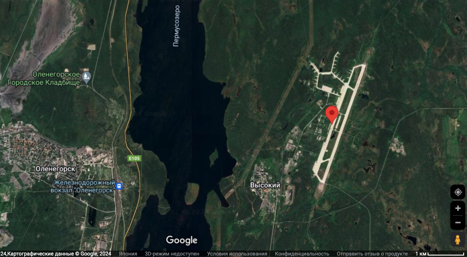
File:OleniaAirbaseMap6.jpg
Size of this preview: 800 × 440 pixels. Other resolutions: 320 × 176 pixels | 1,600 × 880 pixels.
Original file (1,600 × 880 pixels, file size: 328 KB, MIME type: image/jpeg)
Summary
- ↑ https://www.google.com/maps/place/68°09'06.1%22N+33°27'23.8%22E/@68.1505221,33.3703509,7061m/data=!3m1!1e3!4m4!3m3!8m2!3d68.1517!4d33.4566?hl=ru&entry=ttu 68°09'06.1"N 33°27'23.8"E 68.151700, 33.456600 г. Мончегорск, Мурманская обл., Россия
Keywords
File history
Click on a date/time to view the file as it appeared at that time.
| Date/Time | Thumbnail | Dimensions | User | Comment | |
|---|---|---|---|---|---|
| current | 23:03, 31 May 2024 | | 1,600 × 880 (328 KB) | T (talk | contribs) | {{oq|OleniaAirbaseMap6.jpg|}} Olenia Airbase at the Google map <ref> https://www.google.com/maps/place/68°09'06.1%22N+33°27'23.8%22E/@68.1505221,33.3703509,7061m/data=!3m1!1e3!4m4!3m3!8m2!3d68.1517!4d33.4566?hl=ru&entry=ttu 68°09'06.1"N 33°27'... |
- You cannot overwrite this file.
File usage
The following page links to this file: