File:ShaikovaDneprMap.jpg
Size of this preview: 600 × 600 pixels. Other resolutions: 240 × 240 pixels | 864 × 864 pixels.
Original file (864 × 864 pixels, file size: 200 KB, MIME type: image/jpeg)
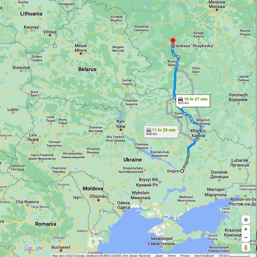
Авиабаза Шайковка (Shaikovka airbase) is some hundred km North from the civilian objects at Dnipro, exploded at the terroristic attack 2023.01.14.
Map by Google [1]
References
- ↑ https://www.google.com/maps/dir/Dnipro,+Dnipropetrovsk+Oblast,+Ukraine,+49000/54.2264,34.3719/@52.3588779,19.6036603,6z/data=!4m8!4m7!1m5!1m1!1s0x40dbe303fd08468f:0xa1cf3d5f2c11aba!2m2!1d35.046183!2d48.464717!1m0 Dnipro, Dnipropetrovsk Oblast, Ukraine, 49000 Airbase "Shaykovka", Shaikovka, Kaluga Oblast, Russia, 249455
File history
Click on a date/time to view the file as it appeared at that time.
| Date/Time | Thumbnail | Dimensions | User | Comment | |
|---|---|---|---|---|---|
| current | 11:39, 16 January 2023 | | 864 × 864 (200 KB) | T (talk | contribs) |
- You cannot overwrite this file.
File usage
The following 3 pages link to this file: