File:Vh75392map1.jpg
Size of this preview: 800 × 417 pixels. Other resolutions: 320 × 167 pixels | 1,919 × 1,000 pixels.
Original file (1,919 × 1,000 pixels, file size: 655 KB, MIME type: image/jpeg)
Summary
div style="margin:-18px -14px 0px -200px; background-color:#fff">
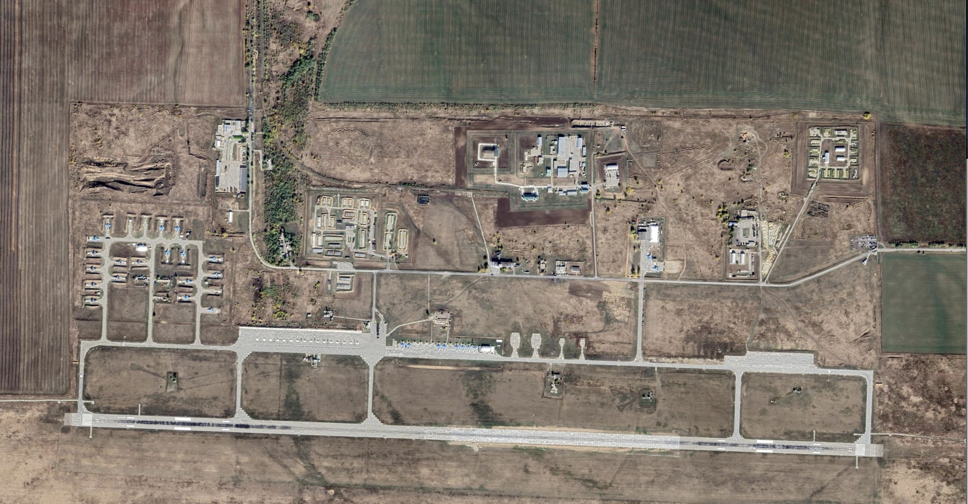
Satellite view of Vh75392 [1].
Coordinates: 48.31199, 41.79454
Address: Morozovsky District, Rostov Oblast, Russia
Short Description
Вч 75392 известна в связи с российским вторжением в Украину, по крайней мере с 2022 года.
Считают, что эта военная база используется для бомбардировок гражданских объектов и, в частности, жилых кварталов Харькова.
Деятельость сотрудников Вч 75392 предлагается квалифицировать по Ст.353 УК РФ.
References
File history
Click on a date/time to view the file as it appeared at that time.
| Date/Time | Thumbnail | Dimensions | User | Comment | |
|---|---|---|---|---|---|
| current | 23:06, 26 March 2022 | | 1,919 × 1,000 (655 KB) | T (talk | contribs) | div style="margin:-18px -14px 0px -200px; background-color:#fff"> <div style="margin:0px 0px 0px 30px; line-height:1.3em"><br> Satellite view of Vh75392 <ref> https://www.google.com/maps/place/Morozovsk,+Rostov+Oblast,+Russia/@48.3170594,41.7880918... |
- You cannot overwrite this file.
File usage
The following page links to this file: