File:ZaesMap.jpg

Size of this preview: 800 × 555 pixels. Other resolutions: 320 × 222 pixels | 1,249 × 866 pixels.
Original file (1,249 × 866 pixels, file size: 126 KB, MIME type: image/jpeg)
Summary
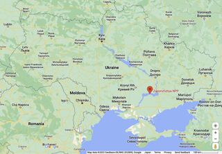
Zaes (Zaporizhzhya NPP, ЗАЭС) at the map of Ukraine by Google [1]
Description
Information about this place may be outdated. Always pay attention to real-world conditions, which may be rapidly changing.
вул. Промислова, 133, Enerhodar, Zaporizhia Oblast, Ukraine, 71500
вул. Промислова, 133, Енергодар, Запорізька область, 71500
References
- ↑ https://www.google.com/maps/place/Zaporizhzhya+NPP/@49.6340353,26.2886104,6.23z/data=!4m5!3m4!1s0x40dcbebe768d89bf:0xa333933b4be25625!8m2!3d47.5067049!4d34.5850769 Zaporizhzhya NPP Запорізька АЕС Nuclear power plant Information about this place may be outdated. Always pay attention to real-world conditions, which may be rapidly changing. вул. Промислова, 133, Enerhodar, Zaporizhia Oblast, Ukraine, 71500 вул. Промислова, 133, Енергодар, Запорізька область, 71500
File history
Click on a date/time to view the file as it appeared at that time.
| Date/Time | Thumbnail | Dimensions | User | Comment | |
|---|---|---|---|---|---|
| current | 10:05, 27 August 2022 | | 1,249 × 866 (126 KB) | T (talk | contribs) | <div style="margin:-18px -14px 0px -200px; background-color:#fff"> <div style="margin:0px 0px 0px 30px; line-height:1.2em"><br> Zaes (Zaporizhzhya NPP, ЗАЭС) at the map of Ukraine by Google <ref> https://www.google.com/maps/place/Zapori... |
- You cannot overwrite this file.
File usage
The following page links to this file: