Difference between revisions of "File:MulinoSat.jpg"
Jump to navigation
Jump to search
| Line 1: | Line 1: | ||
| + | |||
| + | <div style="margin:-18px -14px 0px -200px; background-color:#fff"> |
||
| + | <div style="margin:0px 0px 0px 30px; line-height:1.2em"><br> |
||
| + | |||
| + | [[Мулино]], view by Satellites <ref> |
||
| + | https://satellites.pro/Russia_map#56.3094,42.926,16 |
||
| + | </ref> |
||
| + | |||
| + | Address: |
||
| + | |||
| + | Mulino, Nizhny Novgorod Oblast, Russia |
||
| + | |||
| + | Coordinates: 56.3094,42.9260 |
||
| + | |||
| + | ==References== |
||
| + | <references/> |
||
| + | |||
| + | [[Category:Bavovna]] |
||
| + | [[Category:Mulino]] |
||
| + | [[Category:Putin world war]] |
||
| + | [[Category:Russian invasion into Ukraine]] |
||
| + | [[Category:Satellites]] |
||
| + | [[Category:Target]] |
||
| + | [[Category:Transfer of hostilities to aggressor territory]] |
||
| + | [[Category:War crime]] |
||
| + | [[Category:Vh89425]] |
||
Latest revision as of 19:21, 13 December 2022
File history
Click on a date/time to view the file as it appeared at that time.
| Date/Time | Thumbnail | Dimensions | User | Comment | |
|---|---|---|---|---|---|
| current | 19:20, 13 December 2022 | 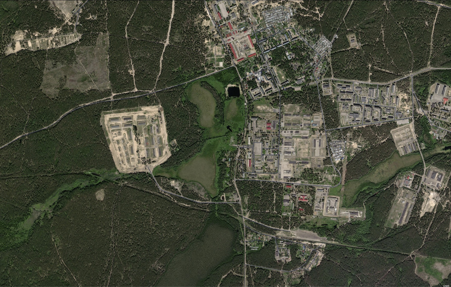 | 1,790 × 1,140 (874 KB) | T (talk | contribs) |
You cannot overwrite this file.
File usage
The following page uses this file: