File:KommunarkaMap.jpg
Revision as of 08:40, 1 December 2018 by Maintenance script (talk | contribs)
KommunarkaMap.jpg (578 × 548 pixels, file size: 138 KB, MIME type: image/jpeg)
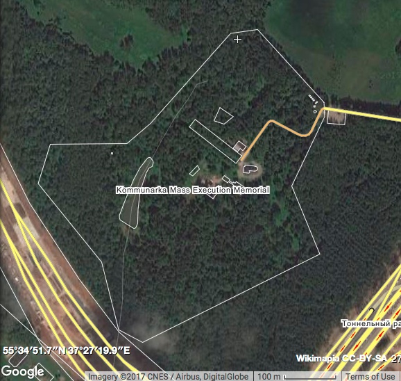
Google map of kommunarka at 55.5792, 37.4558, Soviet concentration camp, used by Soviet fascists for the mass murder an burying of the soviet people.
Description
Kommunarka Mass Execution Memorial (Moscow)
The site of mass executions during Stalin's terror in the 1930s-50s. About 10-14 thousand people are buried here in common graves, only 5 thousand of them could be identified.
References
File history
Click on a date/time to view the file as it appeared at that time.
| Date/Time | Thumbnail | Dimensions | User | Comment | |
|---|---|---|---|---|---|
| current | 06:12, 1 December 2018 |  | 578 × 548 (138 KB) | Maintenance script (talk | contribs) | Importing image file |
You cannot overwrite this file.
File usage
The following page uses this file:
