File:Map51.09307 59.84402vh.jpg

Original file (1,847 × 1,098 pixels, file size: 837 KB, MIME type: image/jpeg)
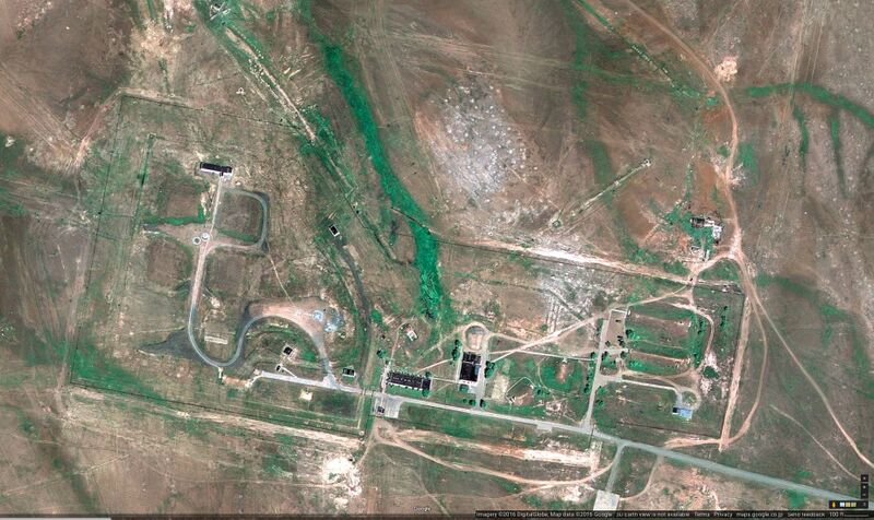
Google map of the rocket base of vh93766 at 51.09307,59.84402
Гуглевская карта космодрома при вч 93766, координаты: 51.09307,59.84402
References
http://www.szn.orb.ru/employer/detail?companyId=3c8bbfb5-4d90-11e5-a1f7-005056876601 ВОЙСКОВАЯ ЧАСТЬ 93766 // Начальник отдела кадров // ИНН / КПП7405012261 / 740501001 // Адрес 385000, г Ясный, р-н Ясненский // Контактный телефон+720514
https://en.wikipedia.org/wiki/Dombarovsky_(air_base) Dombarovsky (also given as Dombarovskiy and Tagilom) is a military airbase 6 kilometres (3.7 mi) northwest of the village of Dombarovsky, near Yasny in Russia's Orenburg Oblast. Operated by the Soviet Air Forces and later by the Russian Air Force, it hosts fighter interceptor squadrons and an ICBM base (which has been adapted for commercial satellite launches).
2014.06.19. http://vz.ru/news/2014/6/19/691970.html Ракета «Сатана» стартовала с пусковой базы «Ясный» на Южном Урале. 19 июня 2014, 23:26
File history
Click on a date/time to view the file as it appeared at that time.
| Date/Time | Thumbnail | Dimensions | User | Comment | |
|---|---|---|---|---|---|
| current | 06:13, 1 December 2018 |  | 1,847 × 1,098 (837 KB) | Maintenance script (talk | contribs) | Importing image file |
You cannot overwrite this file.