Search results
Create the page "Aerial view" on this wiki! See also the search results found.
File:KenigsbergSudMa.jpg [[Центральный райсуд Калининграда]] ), aerial view from its West side.(1,917 × 1,077 (109 KB)) - 17:10, 18 October 2019
File:Katyn2map.jpg Aerial view of place of the [[Katyn-2]] catastrophe.(1,544 × 746 (76 KB)) - 21:02, 20 October 2019
File:BeloyarkaMap0zoomin.jpg ...[Белоярка]], [[Beloyarsk Nuclear plant]], [[Beloyarka]] ), aerial view from the North side.(1,920 × 1,139 (337 KB)) - 01:56, 7 December 2019
File:FSOUBTCsate.jpg Aerial view <ref>(1,831 × 1,022 (520 KB)) - 23:23, 26 May 2020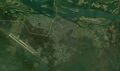
File:KamchatkaMissileBase.jpg Aerial view <ref>https://www.google.com/maps/place/56%C2%B018'31.2%22N+160%C2%B048'26.4(1,820 × 1,076 (375 KB)) - 16:30, 20 October 2020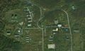
File:KamchatkaTwoCisterns.jpg Aerial view <ref>https://satellites.pro/Russia_map#56.308173,160.846103,19 From the outside view, it is difficult to guess, whet is inside:(1,743 × 1,062 (298 KB)) - 16:33, 20 October 2020
File:I0395rp.jpg at the aerial view of the [[Kamchatka Missile base]] From the outside view, it is difficult to guess, whet is inside:<br>(916 × 615 (122 KB)) - 19:33, 20 October 2020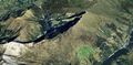
File:DorfliAerial02.jpg Aerial view of mounts above [[Dorfli]](1,917 × 947 (290 KB)) - 16:53, 14 January 2021
File:TanzawaNEtrailheadMap.jpg [[Aerial view]] on the trailhead of the way to Tanzawa from Notrh-East, from road 70, by [[Category:Aerial view]](1,921 × 1,101 (973 KB)) - 21:00, 25 January 2021
File:KibigaraYamaMap01.png Aerial view on mount Kibigara and vicinity.(1,261 × 946 (1.54 MB)) - 15:33, 4 August 2021
File:KibigaraYamaMap01.jpg Aerial view on mount [[Kibigara]] and vicinity.(1,261 × 946 (272 KB)) - 14:19, 6 August 2021
File:Uvarovo airview09.jpg [[Category:Aerial view]](1,200 × 680 (271 KB)) - 00:03, 25 August 2021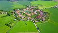
File:Village7.jpg https://www.shutterstock.com/video/clip-27995419-aerial-view-beautiful-village-summer-countryside-circular Aerial view of beautiful village in summer countryside. Circular shape traditional vill(852 × 480 (79 KB)) - 00:06, 25 August 2021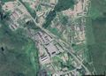
File:Vh38643map1.jpg Aerial view of the Russian military base [[Vh38643]] ([[Вч 38643]]) by Google(1,068 × 761 (334 KB)) - 23:35, 27 December 2021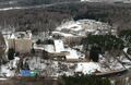
File:File-86538b5bc975ac9d56bd3bf00af682bd.jpg aerial view formEast, [[Category:View]](1,714 × 1,114 (410 KB)) - 04:10, 19 January 2022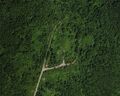
File:Vh14366satFragment.jpg Aerial view by Satellites(800 × 640 (162 KB)) - 17:25, 27 July 2022
File:VolgogradskiVoenAerial.jpg Aerial view by Google <ref>(1,566 × 1,027 (320 KB)) - 16:38, 1 August 2022
File:D4xNXZiYwtA.jpg [[Vh90547]] ([[Вч 89547]]), aerial view.(604 × 402 (96 KB)) - 18:41, 31 January 2023
File:KozachaBuhtaMapiaAerialFromSouth56.jpg </ref>, aerial view from South]. [[Category:Aerial]](782 × 588 (188 KB)) - 01:30, 4 May 2023
File:2023.Bavovn.jpg [[Bavovna]] at the [[Kozacha Bay Fuel Base]], aerial view.(1,187 × 900 (166 KB)) - 01:40, 4 May 2023


