File:FukushimaPowerPlant-1.jpg
FukushimaPowerPlant-1.jpg (582 × 416 pixels, file size: 202 KB, MIME type: image/jpeg)
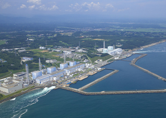
Aerial photo of the Fukushima nuclear plant 日本 〒979-1301 福島県双葉郡大熊町大字夫沢字北原22 0240-32-2101 tepco.co.jp located at http://maps.google.com/maps?f=q&source=s_q&hl=en&geocode=&q=Fukushima+nuclear+plant&aq=&sll=37.0625,-95.677068&sspn=52.550571,88.945313&ie=UTF8&hq=Fukushima+nuclear+plant&hnear=&radius=15000&ll=37.421486,141.035056&spn=0.012321,0.020664&t=h&z=16 seen from the South side. FIle from http://maps.google.com/maps?f=q&source=s_q&hl=en&geocode=&q=Fukushima+nuclear+plant&aq=&sll=37.0625,-95.677068&sspn=52.550571,88.945313&ie=UTF8&hq=Fukushima+nuclear+plant&hnear=&radius=15000&ll=37.468319,140.996475&spn=0.42236,0.484085&z=11 Please attribute the source at the reuse.
File history
Click on a date/time to view the file as it appeared at that time.
| Date/Time | Thumbnail | Dimensions | User | Comment | |
|---|---|---|---|---|---|
| current | 17:50, 20 June 2013 |  | 582 × 416 (202 KB) | Maintenance script (talk | contribs) | Importing image file |
You cannot overwrite this file.
File usage
The following page uses this file:
