File:PasteurInstituteMap.jpg
Jump to navigation
Jump to search


Size of this preview: 800 × 592 pixels. Other resolutions: 320 × 237 pixels | 1,361 × 1,007 pixels.
Original file (1,361 × 1,007 pixels, file size: 197 KB, MIME type: image/jpeg)
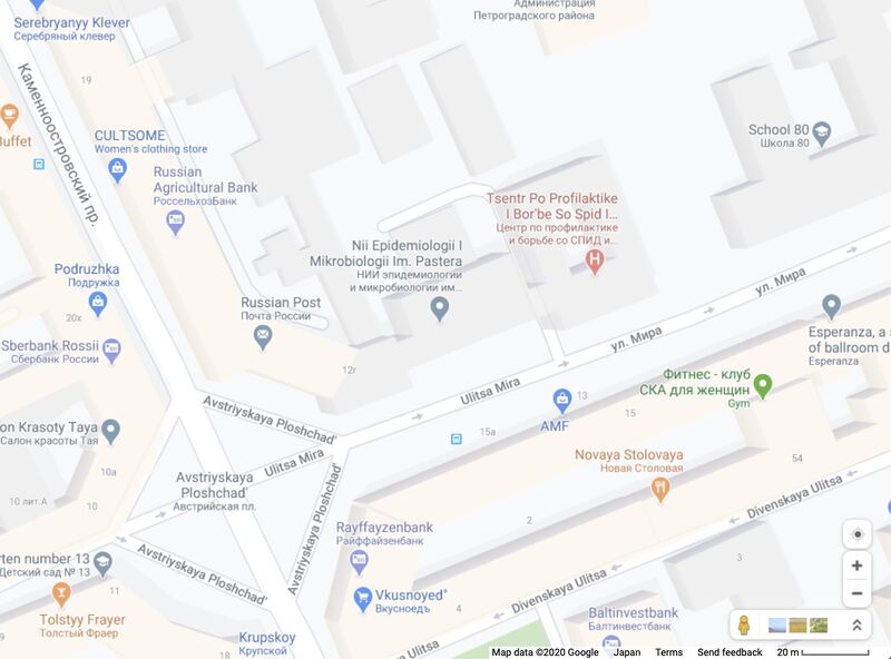
Map [1] of the Peterburg Pasteur Institute (Петербургский институт Пастера), 2020. [2].
Address: Петербург, ул.Мира, д.14
Coordinates: 59.96073, 30.31577
Reference
- ↑ https://www.google.com/maps/@59.9601322,30.3187134,3a,75y,282.87h,90t/data=!3m8!1e1!3m6!1sAF1QipMX3jQ7M_o-Gd2fpYXOnAYBMprKqMpkhRhmlGKL!2e10!3e11!6shttps:%2F%2Flh5.googleusercontent.com%2Fp%2FAF1QipMX3jQ7M_o-Gd2fpYXOnAYBMprKqMpkhRhmlGKL%3Dw203-h100-k-no-pi-0-ya32.52569-ro-0-fo100!7i9400!8i4700
- ↑ https://www.pasteurorg.ru/rubric/278/Kontaktnaya-informaciya Санкт-Петербургский НИИ эпидемиологии и микробиологии имени Пастера. Адрес: 197101, Санкт-Петербург, ул. Мира, д. 14
File history
Click on a date/time to view the file as it appeared at that time.
| Date/Time | Thumbnail | Dimensions | User | Comment | |
|---|---|---|---|---|---|
| current | 00:36, 23 February 2020 |  | 1,361 × 1,007 (197 KB) | T (talk | contribs) |
You cannot overwrite this file.
File usage
The following page uses this file: