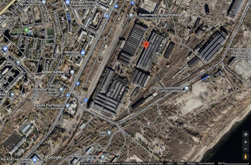
File:VolgogradskiVoenAerial.jpg
Jump to navigation
Jump to search


Size of this preview: 800 × 525 pixels. Other resolutions: 320 × 210 pixels | 1,566 × 1,027 pixels.
Original file (1,566 × 1,027 pixels, file size: 320 KB, MIME type: image/jpeg)
Summary
Волгоградский воензавод , он же («Волгоградский тракторный завод имени Ф.Э.Дзержинского».
Aerial view by Google [1]
Coordinates: 48.795, 44.604
References
- ↑ https://www.google.com/maps/place/Volgogradskiy+Traktornyy+Zavod+Imeni+F.e.dzerzhinskogo/@48.8007243,44.5987271,16.14z/data=!4m12!1m6!3m5!1s0x411ab459192c076d:0xa50075cc2aa22c08!2sVolgogradskiy+Traktornyy+Zavod+Imeni+F.e.dzerzhinskogo!8m2!3d48.8022628!4d44.6062181!3m4!1s0x411ab459192c076d:0xa50075cc2aa22c08!8m2!3d48.8022628!4d44.6062181
File history
Click on a date/time to view the file as it appeared at that time.
| Date/Time | Thumbnail | Dimensions | User | Comment | |
|---|---|---|---|---|---|
| current | 16:37, 1 August 2022 |  | 1,566 × 1,027 (320 KB) | T (talk | contribs) |
You cannot overwrite this file.
File usage
The following page uses this file: