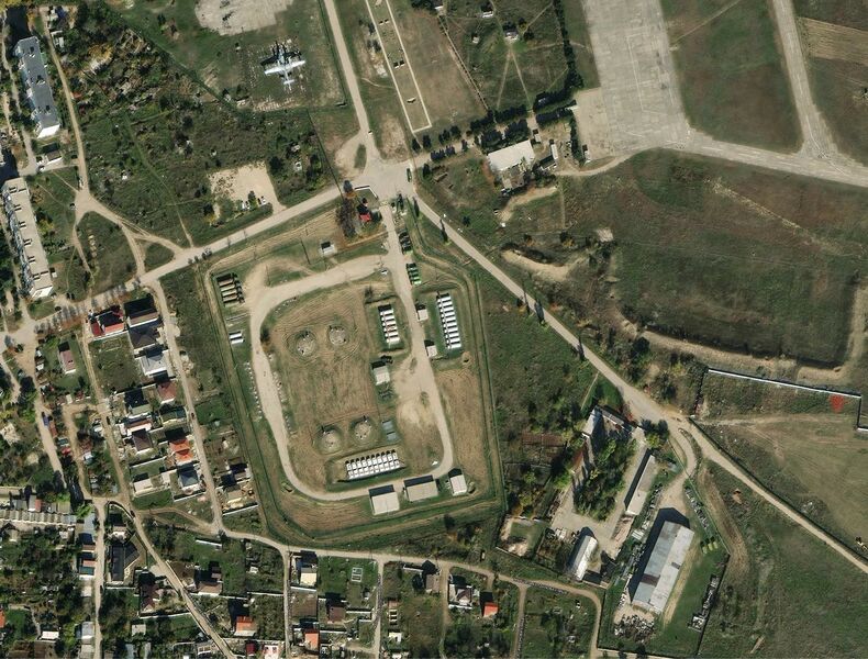
File:KachaFuel.jpg
Revision as of 22:43, 17 August 2022 by T (talk | contribs) (Satellite <ref>https://satellites.pro/Ukraine_map#44.776128,33.549651,19</ref> at 44.7761,33.5496 looks as a fuel storage of Вч 49311 ==References== <references/> Category:Annexation of Crimea Category:Budapest memorandum [[Category:Cor...)

Size of this preview: 790 × 600 pixels. Other resolutions: 316 × 240 pixels | 1,462 × 1,110 pixels.
Original file (1,462 × 1,110 pixels, file size: 319 KB, MIME type: image/jpeg)
File history
Click on a date/time to view the file as it appeared at that time.
| Date/Time | Thumbnail | Dimensions | User | Comment | |
|---|---|---|---|---|---|
| current | 22:43, 17 August 2022 |  | 1,462 × 1,110 (319 KB) | T (talk | contribs) | Satellite <ref>https://satellites.pro/Ukraine_map#44.776128,33.549651,19</ref> at 44.7761,33.5496 looks as a fuel storage of Вч 49311 ==References== <references/> Category:Annexation of Crimea Category:Budapest memorandum [[Category:Cor... |
You cannot overwrite this file.
File usage
The following page uses this file: