File:MirnyArhanfelskoiMapia02.jpg
Jump to navigation
Jump to search

Size of this preview: 800 × 428 pixels. Other resolutions: 320 × 171 pixels | 1,224 × 655 pixels.
Original file (1,224 × 655 pixels, file size: 96 KB, MIME type: image/jpeg)
Summary
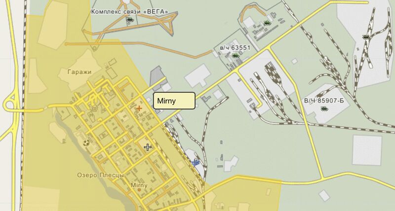
Mirny of Archangelsk region, Vh42670, Vh63551, Vh85907-b by Wikimapia
Мирный Архангельской области, Вч 42670, Вч 63551, Вч 85907-Б by Wikimapia [1]
Coordinates: 62.7625,40.3396
References
- ↑ https://wikimapia.org/#lang=en&lat=62.762505&lon=40.339565&z=13&m=w&show=/10733417/ru/В-ч-42670&search=62.76977334054472%2C%2040.36028441973787 В/ч 42670 (Мирный) Russia / Arhangelsk / Plesetsk / Мирный military, housing services (2022)
File history
Click on a date/time to view the file as it appeared at that time.
| Date/Time | Thumbnail | Dimensions | User | Comment | |
|---|---|---|---|---|---|
| current | 17:14, 7 November 2022 |  | 1,224 × 655 (96 KB) | T (talk | contribs) | <div style="margin:-18px -14px 0px -200px; background-color:#fff"> <div style="margin:0px 0px 0px 30px; line-height:1.2em"><br> Mirny of Archangelsk region, Vh42670, Vh63551, Vh85907-b by Wikimapia Мирный Архангельс... |
You cannot overwrite this file.
File usage
The following page uses this file: