File:KrymskAirbaseIlskOilMap.jpg
Jump to navigation
Jump to search


Size of this preview: 800 × 435 pixels. Other resolutions: 320 × 174 pixels | 1,918 × 1,042 pixels.
Original file (1,918 × 1,042 pixels, file size: 490 KB, MIME type: image/jpeg)
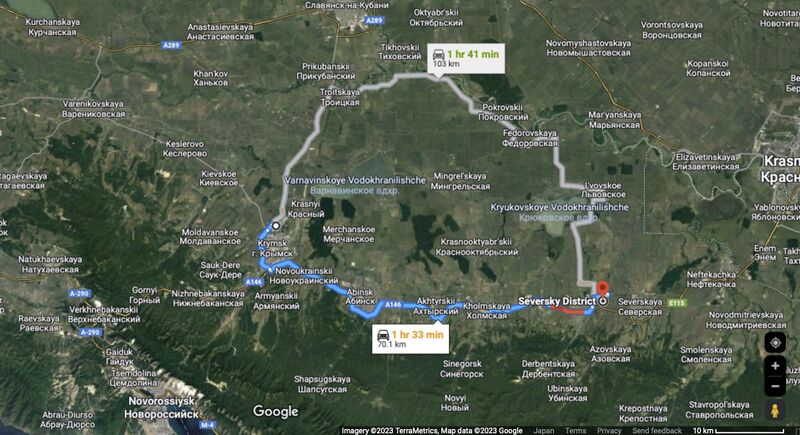
The Krymsk airbase is 70 km from the Ilsk oil refinery (Ильский нефтеперерабатывающий завод.
Image by Google [1]
Coordinates:
44.8605,38.6067 Krymsk airbase
44.8605,38.6067 Ilsk oil refinery
- ↑ https://www.google.co.jp/maps/dir/44.9612,+37.9909/44.8605,38.6067/@44.9982553,37.9922304,70295m/data=!3m1!1e3!4m8!4m7!1m5!1m1!1s0x0:0x38928d1902913708!2m2!1d37.9909!2d44.9612!1m0?hl=en 44.8605,38.6067 Seversky District, Krasnodar Krai, Russia // 44.9612,37.9909 Krymsky District, Krasnodar Krai, Russia
File history
Click on a date/time to view the file as it appeared at that time.
| Date/Time | Thumbnail | Dimensions | User | Comment | |
|---|---|---|---|---|---|
| current | 15:37, 6 May 2023 |  | 1,918 × 1,042 (490 KB) | T (talk | contribs) |
You cannot overwrite this file.
File usage
The following page uses this file: