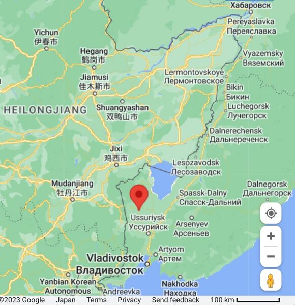
File:PrimorieSergeevkaMap01.jpg
Jump to navigation
Jump to search

Size of this preview: 580 × 600 pixels. Other resolutions: 232 × 240 pixels | 699 × 723 pixels.
Original file (699 × 723 pixels, file size: 168 KB, MIME type: image/jpeg)
Summary
- ↑ https://www.google.com/maps/search/44.3297,131.6677+Сергеевка/@45.910062,123.0237477,6z?entry=ttu Sergeevka Сергеевка Primorsky Krai Russia 692591
File history
Click on a date/time to view the file as it appeared at that time.
| Date/Time | Thumbnail | Dimensions | User | Comment | |
|---|---|---|---|---|---|
| current | 06:19, 18 July 2023 |  | 699 × 723 (168 KB) | T (talk | contribs) | <div style="margin:-18px -14px 0px -200px; background-color:#fff"> <div style="margin:0px 0px 0px 30px; line-height:1.2em"><br> Сергеевка Приморской, Вч 25573 и Вч 44980 (Red mark) at the Google map <ref><small> http... |
You cannot overwrite this file.
File usage
The following page uses this file: