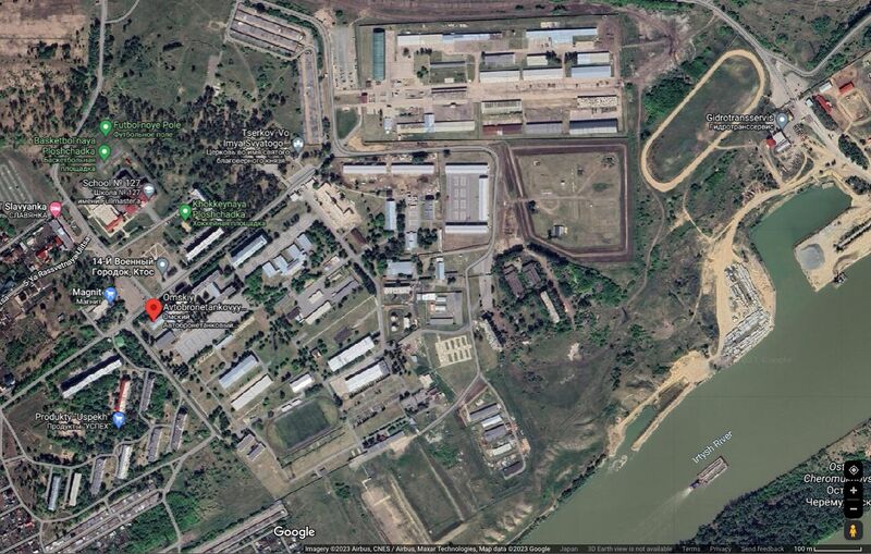
File:OmskiMap04.jpg
Revision as of 10:44, 19 August 2023 by T (talk | contribs) (== Summary == <div style="margin:-18px -14px 0px -200px; background-color:#fff"> <div style="margin:0px 0px 0px 30px; line-height:1.2em"><br> Омский Автобронетанковый Инженерный Институт ([[Omskiy Avtobrone...)

Size of this preview: 800 × 509 pixels. Other resolutions: 320 × 203 pixels | 1,194 × 759 pixels.
Original file (1,194 × 759 pixels, file size: 451 KB, MIME type: image/jpeg)
Summary
Омский Автобронетанковый Инженерный Институт (Omskiy Avtobronetankovyy Inzhenernyy Institut) and Вч 83444 («504-й танковый полк», Vh83444) на гуглевской карте [1].
Address: Ulitsa Voyennyy 14-Y Gorodok, 119, Omsk, Omsk Oblast, Russia, 644098 //
Coordinates: 54.8464, 73.4048 Reception
References
- ↑ https://www.google.com/maps/place/Omskiy+Avtobronetankovyy+Inzhenernyy+Institut/@54.8475486,73.4091462,1224m/data=!3m1!1e3!4m6!3m5!1s0x43ab1d09821c7c7f:0xb0e5b6728c56663d!8m2!3d54.8463132!4d73.4054984!16s%2Fg%2F121z21dc?entry=ttu Omskiy Avtobronetankovyy Inzhenernyy Institut// Омский Автобронетанковый Инженерный Институт// Ulitsa Voyennyy 14-Y Gorodok, 119, Omsk, Omsk Oblast, Russia, 644098 // Coordinates: 54.8464, 73.4048 Reception
File history
Click on a date/time to view the file as it appeared at that time.
| Date/Time | Thumbnail | Dimensions | User | Comment | |
|---|---|---|---|---|---|
| current | 10:44, 19 August 2023 |  | 1,194 × 759 (451 KB) | T (talk | contribs) | == Summary == <div style="margin:-18px -14px 0px -200px; background-color:#fff"> <div style="margin:0px 0px 0px 30px; line-height:1.2em"><br> Омский Автобронетанковый Инженерный Институт ([[Omskiy Avtobrone... |
You cannot overwrite this file.
File usage
The following page uses this file: