File:UralmashMap7.jpg
Revision as of 18:21, 13 April 2024 by T (talk | contribs) (== Summary == {{oq|UralmashMap7.jpg|}} Уралмаш (Уралмашзавод, Uralmashzavod) на гуглевской карте<ref> https://www.google.co.jp/maps/place/56°52'47.6%22N+60°35'34.1%22E/@56.8823239,60.5822536,2657m/data...)

Size of this preview: 800 × 410 pixels. Other resolutions: 320 × 164 pixels | 1,920 × 984 pixels.
Original file (1,920 × 984 pixels, file size: 1.09 MB, MIME type: image/jpeg)
Summary
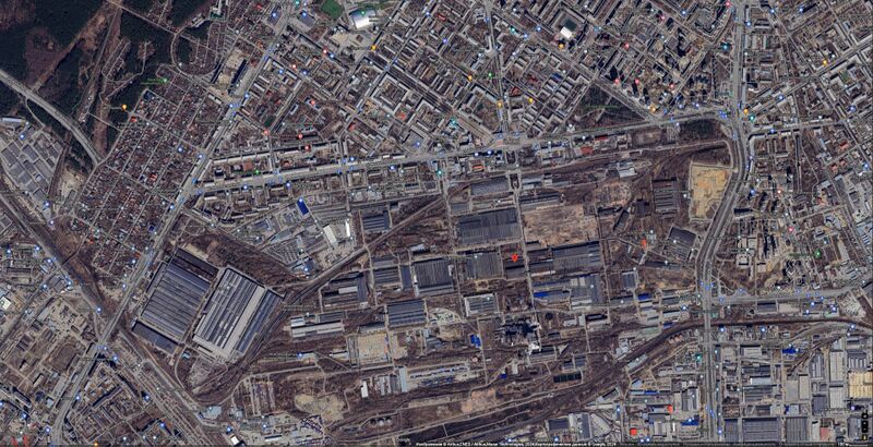
Уралмаш (Уралмашзавод, Uralmashzavod) на гуглевской карте[1]
Description
56°52'47.6"N 60°35'34.1"E
56.879900, 60.592800
Орджоникидзевский р-н, Екатеринбург, Свердловская обл., Россия
References
- ↑ https://www.google.co.jp/maps/place/56°52'47.6%22N+60°35'34.1%22E/@56.8823239,60.5822536,2657m/data=!3m1!1e3!4m4!3m3!8m2!3d56.8799!4d60.5928?hl=ru&entry=ttu 56°52'47.6"N 60°35'34.1"E 56.879900, 60.592800 Орджоникидзевский р-н, Екатеринбург, Свердловская обл., Россия
Keywords
«Anexation of Crimea», «Budapest memorandum», «Uralmash», «Uralmashzavod», «[[]]»,
«Уралмаш», «Уралмашзавод»,
File history
Click on a date/time to view the file as it appeared at that time.
| Date/Time | Thumbnail | Dimensions | User | Comment | |
|---|---|---|---|---|---|
| current | 18:21, 13 April 2024 |  | 1,920 × 984 (1.09 MB) | T (talk | contribs) | == Summary == {{oq|UralmashMap7.jpg|}} Уралмаш (Уралмашзавод, Uralmashzavod) на гуглевской карте<ref> https://www.google.co.jp/maps/place/56°52'47.6%22N+60°35'34.1%22E/@56.8823239,60.5822536,2657m/data... |
You cannot overwrite this file.
File usage
The following page uses this file: