File:UkraineKarafutoYande8.png
Jump to navigation
Jump to search


Size of this preview: 800 × 358 pixels. Other resolutions: 320 × 143 pixels | 1,608 × 720 pixels.
Original file (1,608 × 720 pixels, file size: 105 KB, MIME type: image/png)
Summary
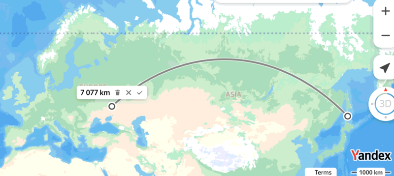
Measurement of distance from Ukraine to Karafuto with Yabdex[1] : approximately, 7 megameters.
Example of use (with labels):
Moscovia
Ukraine
Вч 93992
Karafuto
Japan
Казахстан
Mongolia
China
References
Keywords
«Japan», «Karafuto», «Map», «South Karafuto Airbase», «Ukraine», «Вч 93992», «Карафуто», «Перенос боевых действий на территорию страны агрессора», «Украина», «Уралвагонзавод», «Япония»,
File history
Click on a date/time to view the file as it appeared at that time.
| Date/Time | Thumbnail | Dimensions | User | Comment | |
|---|---|---|---|---|---|
| current | 09:31, 22 June 2024 |  | 1,608 × 720 (105 KB) | T (talk | contribs) | {{oq|UkraineKarafutoYande8.png|}} Measurement of distance from Ukraine to Karafuto with Yabdex<ref> https://yandex.com/maps/?ll=117.166918%2C60.293371&rl=142.539496%2C46.948508~-104.530357%2C2.786497&z=2.37 </ref> : approximately, 7 megameters. Examp... |
You cannot overwrite this file.
File usage
The following 5 pages use this file:
