File:FedotovoAirbaseLocalMap.jpg
Contents
Summary
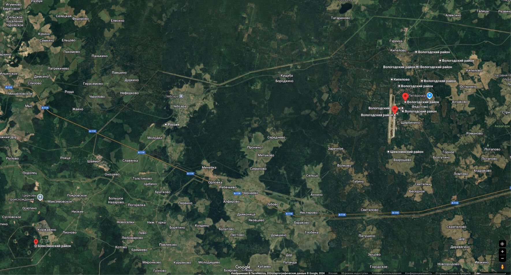
Fedotovo Airbase and vicinities at the Google maps. The following objects are marked:

59.2365,39.1598 Rilroad junction
59.2354,38.4893 Sheksna dam
59.2305,39.1935 L59.23053z39.1935 not specified
59.2259,39.1627 Railroad stop
59.2258,39.1610 Fuel storage
59.2169,39.1256 North landing beacon
59.2159,39.1678 electric substation, Электрическая подстанция«Кипелово»110-10кВ
59.2121,39.1360 Arsenal
59.2008,39.1445 Arsenal
59.1964,39.1405 Fuel storage
59.1941,39.1412 L59.1941z39.1412 Not specified; perhaps, underground arsenal
59.1914,39.1298 Warplane parking
59.1845,38.8095 Vh25594 (Вч 25594)
59.1650,39.1211 South landing beacon
59.1464,38.5292 Gas pipe station
59.1377,38.5258 L59.1377z38.5258 not specified
59.0973,38.6277 Arsenal Vh25594 (Вч 25594)
Warning
The objects marked are identified from the maps available in the free access. The verification and/or the correction should be appreciated.
References
Keyowrds
«[[]]», «Fedotovo Airbase»,
File history
Click on a date/time to view the file as it appeared at that time.
| Date/Time | Thumbnail | Dimensions | User | Comment | |
|---|---|---|---|---|---|
| current | 15:30, 6 September 2024 | | 1,770 × 954 (306 KB) | T (talk | contribs) | {{oP}} Fedotovo Airbase and vicinities at the Google maps. The following objects are marked: <div class="thumb tright" style=float:right; margin:-40px 0px 0px 8px"> {{pic|FedotovoAirbaseLocalMap.jpg|600px}} <p style="margin:-12px 0px 12px 0px;"><s... |
- You cannot overwrite this file.
File usage
The following 2 pages link to this file: