Difference between revisions of "File:Shikotango.jpg"
(Importing image file) |
|||
| Line 1: | Line 1: | ||
| + | Satellite view of the central part of island Shikotan with the structures that look like а water-capturers and water-drains; no site of the factory is found in the WEB. |
||
| − | Importing image file |
||
| + | |||
| + | The image is got through the GoogleMap for the analysis of possible source(s) of contamination that is usually attributed to the [[Fukushima disaster]]. |
||
| + | |||
| + | [[Category:Fukushima disaster]] |
||
| + | [[Category:Satellite view]] |
||
| + | [[Category:Kuril islands]] |
||
Latest revision as of 09:38, 21 June 2013
Satellite view of the central part of island Shikotan with the structures that look like а water-capturers and water-drains; no site of the factory is found in the WEB.
The image is got through the GoogleMap for the analysis of possible source(s) of contamination that is usually attributed to the Fukushima disaster.
File history
Click on a date/time to view the file as it appeared at that time.
| Date/Time | Thumbnail | Dimensions | User | Comment | |
|---|---|---|---|---|---|
| current | 17:50, 20 June 2013 | 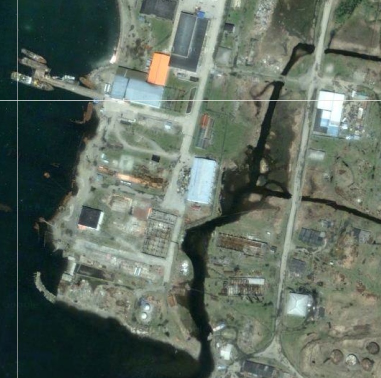 | 762 × 757 (175 KB) | Maintenance script (talk | contribs) | Importing image file |
- You cannot overwrite this file.
File usage
There are no pages that link to this file.