File:Tamura20130526map.png
Revision as of 09:45, 21 June 2013 by Maintenance script (talk | contribs)

Size of this preview: 673 × 599 pixels. Other resolutions: 270 × 240 pixels | 1,067 × 950 pixels.
Original file (1,067 × 950 pixels, file size: 826 KB, MIME type: image/png)
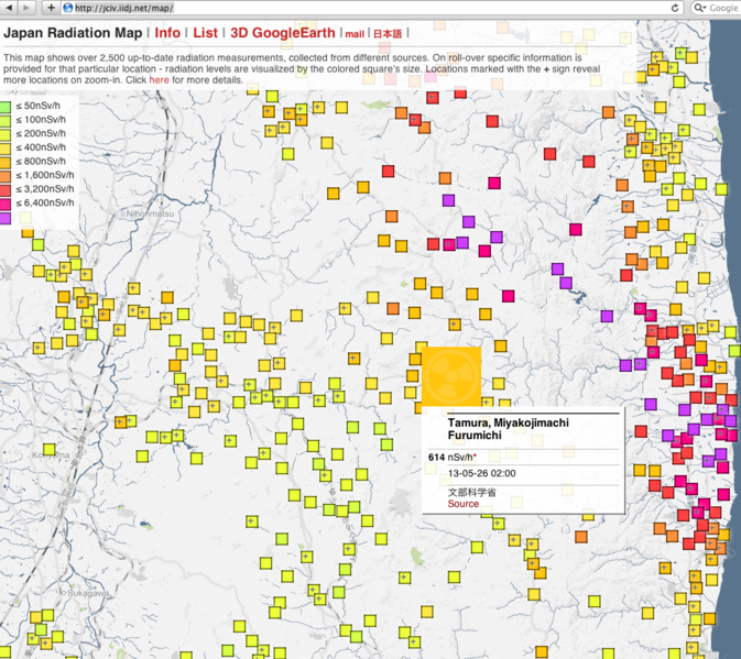
Screenshot by [1], for Tamura Miyakojimachi Furumichi. 13-05-26 02:00, suggests 614 nSv/h.
References
- ↑ http://jciv.iidj.net/map/ Japan radiation map. state for 2013 May 26, for Tamura Miyakojimachi Furumichi suggests 614 nSv/h.
File history
Click on a date/time to view the file as it appeared at that time.
| Date/Time | Thumbnail | Dimensions | User | Comment | |
|---|---|---|---|---|---|
| current | 17:50, 20 June 2013 | | 1,067 × 950 (826 KB) | Maintenance script (talk | contribs) | Importing image file |
- You cannot overwrite this file.
File usage
There are no pages that link to this file.