Search results
Create the page "Trail" on this wiki! See also the search results found.
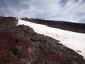
File:03095SnowArFuji.jpg Significant part of trail is covered with steep snow.(2,048 × 1,536 (1.31 MB)) - 08:24, 1 December 2018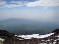
File:03106fujiTrailCoveredBySnow.jpg Trail covered by snow, view from the Crater.(2,048 × 1,536 (1.27 MB)) - 08:24, 1 December 2018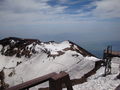
File:03109fujiCraterFromSummit.jpg View of the upper part of the trail and the crater from the summit of Fuji san.(2,048 × 1,536 (1.24 MB)) - 08:24, 1 December 2018
File:TrailAcrossGasonDSCN5229.jpg Pedestrian trail cuts the corner of rectangular gas on(1,100 × 677 (277 KB)) - 08:54, 1 December 2018
File:MzAxMTkwNw.jpeg ...ect to that work. In that work in fact, the network was just recognizing a trail and deriving, from the output, a discrete action to take (center, left, rig ...he case for example when placing the drone within a forest without a clear trail to be followed.(1,240 × 827 (505 KB)) - 19:53, 4 January 2020
File:SnowTreesInga.jpg Snow, trees and ski trail by [[Татьяна Мишустина]], 2020(511 × 768 (116 KB)) - 16:58, 20 January 2020
File:04375fuji.jpg View at Fuji from trail to Sannoto(2,048 × 1,536 (1.36 MB)) - 12:45, 22 November 2020
File:04379firstRefugeSma.jpg First refuge Sannoto on the trail from road 70 to Tounnodake(2,048 × 1,536 (1.03 MB)) - 12:49, 22 November 2020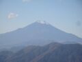
File:04376fuji.jpg View at Fuji san from the trail to Sannoto.(2,048 × 1,536 (975 KB)) - 18:05, 22 November 2020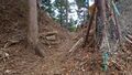
File:04476throughFence.jpg Saddle point of the trail along river Hayato.(1,920 × 1,080 (899 KB)) - 16:45, 1 December 2020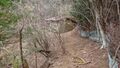
File:04477refuge.jpg Refuge at the trail along river Hayato.(1,920 × 1,080 (855 KB)) - 16:48, 1 December 2020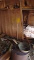
File:04478refuge.jpg Refuge at trail along river Hayato, inside.(1,080 × 1,920 (838 KB)) - 16:50, 1 December 2020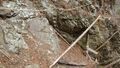
File:04479walkByLog.jpg Log as bridge at the trail along Hayato river.(1,920 × 1,080 (856 KB)) - 16:54, 1 December 2020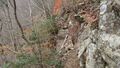
File:04489brokenBridge.jpg Broken bridge at the trail.(1,920 × 1,080 (859 KB)) - 17:14, 1 December 2020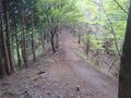
File:04772TrailRidge.jpg [[2021.05.15.Aone]] hike: Trail at the ridge. [[Category:Trail]](2,408 × 1,806 (1.77 MB)) - 23:31, 16 May 2021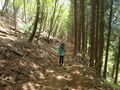
File:04773shoka.jpg [[2021.05.15.Aone]] hike: trail(2,408 × 1,806 (1.78 MB)) - 23:32, 16 May 2021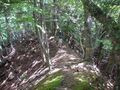
File:04797shokoRidge.jpg [[2021.05.23.Hike]]: Trail at ridge(2,189 × 1,642 (1.47 MB)) - 22:20, 23 May 2021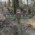
File:Himetugi2.jpeg Board at the trail from mount [[Himetsugi]] to mount [[Hirugatake]](225 × 225 (14 KB)) - 05:37, 6 August 2021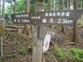
File:04974himetsugu26.jpg Trail from [[Yakiyama]] to [[Himetugi]].(2,048 × 1,536 (1.34 MB)) - 10:52, 6 August 2021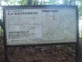
File:04977map.jpg [[2021.07.31.Hike]], first day; trail from [[Yakiyama]] to [[Himetugu]].(2,048 × 1,536 (1.22 MB)) - 10:59, 6 August 2021


