Search results
Create the page "Aerial view" on this wiki! See also the search results found.
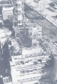
File:4block-698x1024.jpg [[Chernobyl disaster]], Aerial view of the ruins of the building of the 4th block, when the reactor and its con(698 × 1,024 (199 KB)) - 09:41, 21 June 2013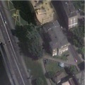
File:Ham100.jpg [[Category:Aerial view]](554 × 554 (48 KB)) - 09:42, 21 June 2013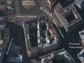
File:Kgbmap0.jpg Aerial view of Lubyaka, main office of the [[KGB]], ideologic police of the USSR and th VIew at the approach from the North–East, approx., year 2006–2009,(1,279 × 959 (85 KB)) - 08:39, 1 December 2018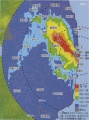
File:Newton2011 7 27b.jpg The view covers the range approximately $140.0<\delta<141.1$, $36.8<\alpha<38.0~$. ...ents the Pacific Ocean, that does not show its contamination at the aerial view.(1,025 × 1,377 (81 KB)) - 09:38, 21 June 2013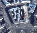
File:Lubianka2013aug.jpg Aerial view of Lubyaka, main office of the [[KGB]], ideologic police of the [[USSR]] an VIew at the approach from the South–West, year 2010.(2,076 × 1,868 (828 KB)) - 08:42, 1 December 2018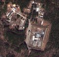
File:Reshety.jpg aerial view.(1,909 × 1,839 (1.29 MB)) - 11:02, 27 August 2013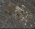
File:35.58194 139.37917.jpg An aerial view of a warehouse which caught fire after an explosion at the US Army Sagami g(1,346 × 1,102 (607 KB)) - 08:27, 1 December 2018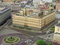
File:LubiankaS.jpg Aerial view of Lubyanka at the approach from South.(260 × 194 (16 KB)) - 08:42, 1 December 2018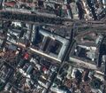
File:Motf02.jpg [[MO RF]], aerial view at the approach from East.(1,078 × 939 (338 KB)) - 08:43, 1 December 2018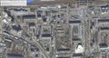
File:Oktiabrskaya7zheleznoforozhnyy.jpg Aerial view of(1,662 × 890 (548 KB)) - 08:45, 1 December 2018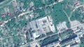
File:Vch48886.jpg Aerial view of [[В/ч № 48886]] by Google for 2015.02.02.(1,678 × 944 (549 KB)) - 08:55, 1 December 2018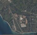
File:Vh09332.jpg [[Vh09332]] ([[вч 09332]]), aerial view by Google.(1,142 × 1,099 (280 KB)) - 08:55, 1 December 2018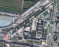
File:Vh21208.jpg Aerial view by Google,(1,302 × 1,026 (593 KB)) - 08:55, 1 December 2018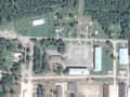
File:Vh21797map1.jpg [[вч 21797]] ( [[Vh21797]] ), aerial view.(1,075 × 809 (268 KB)) - 08:55, 1 December 2018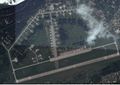
File:Vh41486airstrip.jpg Aerial view of the airstrip of [[Vh41486]] at Tver, Russia (migalovo)(1,538 × 1,090 (295 KB)) - 08:55, 1 December 2018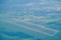
File:Vh69806.430x280.jpg [[vh69806]] ([[вч 69806]]), aerial view(430 × 280 (72 KB)) - 08:55, 1 December 2018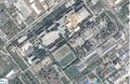
File:Vh73612map0.jpg [[vh73612]] ([[вч 73612]]), aerial view by google.(1,667 × 1,090 (723 KB)) - 08:55, 1 December 2018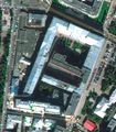
File:Znamenka19.jpg Aerial view of the Russian ministry of Defence, Znamenka 18.(796 × 911 (134 KB)) - 08:57, 1 December 2018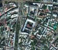
File:Znamenka19Large3.jpg Moscow, Znamenka 19 aerial view.(1,216 × 1,037 (531 KB)) - 08:57, 1 December 2018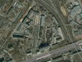
File:NiiohtMap.jpeg Aerial view of [[Niioht]], Moscow.(1,262 × 958 (466 KB)) - 19:10, 23 December 2018


