Search results
Create the page "Google map" on this wiki! See also the search results found.
File:Skriabina26k1.jpg Google map at [[Category:Map]](1,456 × 884 (162 KB)) - 08:52, 1 December 2018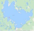
File:Syamozero61.92map33.05g.jpg Google map of [[Syamozero]] https://www.google.com/maps/@61.92,33.05,12z(864 × 774 (96 KB)) - 08:53, 1 December 2018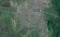
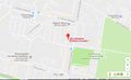
File:TambovMapVasilieva7.jpg Google map of ulitsa Borisa Vasilyeva, 7, Tambov, Tambovskaya oblast', Russia.(1,564 × 977 (412 KB)) - 08:53, 1 December 2018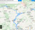
File:Toliatti02.jpg Google map of the Malmyzhsky Distrit, Kirov Oblast. [[Category:Google map]](1,218 × 1,069 (234 KB)) - 08:54, 1 December 2018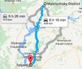
File:Tolyatti03.jpg и Тольятти (Екатерина) by Google map. [[Category:Google map]](557 × 475 (50 KB)) - 08:54, 1 December 2018
File:TsarBombMap01.jpg Google map at by https://www.google.com/maps/place/73%C2%B048'26.0%22N+54%C2%B058'54.0%22E/@73.8088256,54.94900(1,385 × 1,079 (330 KB)) - 08:54, 1 December 2018
File:TumenSchool92map.jpg Google map at 57.10915, 65.57549 https://www.google.co.jp/maps/place/Tyumen,+Tyumen+Oblast,+Russia/@57.1122216,65.562291,1461m/(643 × 744 (265 KB)) - 08:54, 1 December 2018
File:TumenSchool92map2.jpg Google map at 57.10915, 65.57549 https://www.google.co.jp/maps/place/Shkola+№+92/@57.1130197,65.557109,1189m/data=!3m1!1e3!4m(857 × 436 (208 KB)) - 08:54, 1 December 2018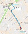
File:Tverskaya5.jpg Google map at Moscow, Tverskaya 5 [[Category:Map]](368 × 448 (79 KB)) - 08:54, 1 December 2018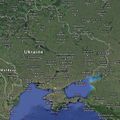
File:UkraineRF.jpg [[Map]] of the border between Ukraine and Russia by https://www.google.com/maps/@45.3185042,38.7491529,963803m/data=!3m1!1e3(626 × 628 (192 KB)) - 08:55, 1 December 2018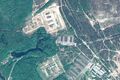
File:Vh02511map.jpg [[Category:Google map]] [[Category:Map]](1,665 × 1,107 (741 KB)) - 08:55, 1 December 2018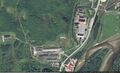
File:Vh08275map1.jpg Google map near coordinates 69.553588, 31.218235 https://www.google.co.jp/maps/place/69°33'12.9%22N+31°13'05.7%22E/@69.5549972,31.2138576,937(1,782 × 1,085 (844 KB)) - 08:55, 1 December 2018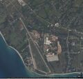
File:Vh09332.jpg [[Vh09332]] ([[вч 09332]]), aerial view by Google. [[Category:Map]](1,142 × 1,099 (280 KB)) - 08:55, 1 December 2018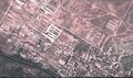
File:Vh12128map1.jpg Google map of [[vh12128]] ([[Вч 12128]]) at 52.54826, 52.81662 [[Category:Map]](1,853 × 1,090 (1.04 MB)) - 08:55, 1 December 2018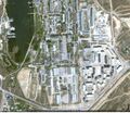
File:Vh13140map0.jpg Google map of [[Vh13140]] ([[Вч 13140]]) at 44.56377,33.41643(1,272 × 1,105 (487 KB)) - 08:55, 1 December 2018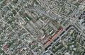
File:Vh22220dzer.jpg [[Category:Google map]] [[Category:Map]](1,513 × 981 (711 KB)) - 08:55, 1 December 2018
File:Vh22220map.jpg Google map of the [[Vh22220]], Volgograd [[Category:Google map]](1,375 × 1,097 (605 KB)) - 08:55, 1 December 2018
File:Vh22290gogle.jpg Google map of [[Vh22290]] ([[вч 22290]]) In vicinity (at the same map), several Russian military divisions are placed.(1,532 × 969 (501 KB)) - 08:55, 1 December 2018
File:Vh32010map1.jpg Google map at 55.4097, 36.7121 [[Category:Map]](1,632 × 1,096 (609 KB)) - 08:55, 1 December 2018
File:Vh32306se.jpg Map of [[Vh32408]] believed to send terrorists to Ukraine in order to shut–do South–East side by Google(1,653 × 975 (536 KB)) - 08:55, 1 December 2018


