File:KurskSat01.jpg

Summary
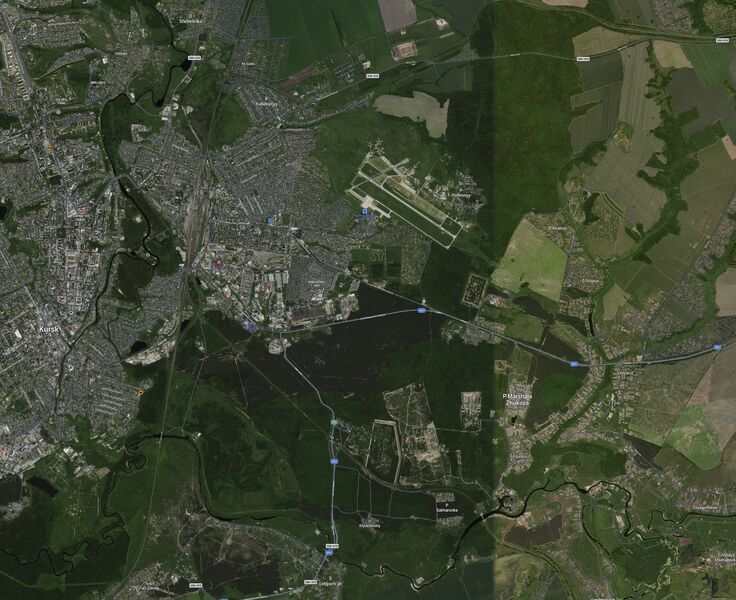
Kursk airbase (Авиабаза Курск), the fuel storage and the arsenals.
Image by Satellites [1]
Address:
Coordinates:
At the north-east from the main airstrip, several round objects are seen that can be interreted as the fuel storage.
At south and south-east, several rectangular and polygonal objects are seen, that seem to be surrounded by strong fence and can be interpreted as arsenals.
The Kursk airbase is suspected to be used in the destruction of the energetic infrastructure of Ukraine (Total war) at the Russia-Ukraine war (Russian invasion into Ukraine)
It will be interesting to check the identification above comparing the image from year 2022 to the similar image of year 2023, in order to check (confirm or negate) the identification above; id the objects mentioned are indeed file storage and/or the arsenals, they are expected suffer some bavovnas that are supposed to be seen at the satellite image.
References
File history
Click on a date/time to view the file as it appeared at that time.
| Date/Time | Thumbnail | Dimensions | User | Comment | |
|---|---|---|---|---|---|
| current | 14:25, 11 December 2022 | | 1,327 × 1,081 (532 KB) | T (talk | contribs) | <div style="margin:-18px -14px 0px -200px; background-color:#fff"> <div style="margin:0px 0px 0px 30px; line-height:1.2em"><br> Kursk airbase (Авиабаза Курск), the fuel storage and the arsenals. Image by Satellites <ref> https://s... |
- You cannot overwrite this file.
File usage
The following page links to this file: