File:Fukucher.jpg
Revision as of 09:38, 21 June 2013 by Maintenance script (talk | contribs)

Size of this preview: 800 × 518 pixels. Other resolutions: 320 × 207 pixels | 2,242 × 1,453 pixels.
Original file (2,242 × 1,453 pixels, file size: 694 KB, MIME type: image/jpeg)
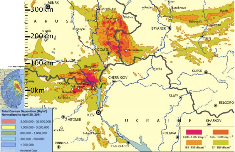
Combining of the maps [1] about the Chernobyl disaster at right and the map of the fallout after the Fukushima from the MEXT publication [2]
Copyleft May 2011, Dmitrii Kouznetsov. This is derivative work; so, the original sources aso shoud be attributed.
References
- ↑ http://www.unscear.org/docs/reports/2008/11-80076_Report_2008_Annex_D.pdf SOURCES AND EFFECTS OF IONIZING RADIATION. United Nations Scientific Committee on the Effects of Atomic Radiation. UNSCEAR 2008 Report to the General Assembly with Scientific Annexes. VOLUME II Scientific Annexes C, D and E. United Nation, United Nations, April 2011. ANNEX d. HEALTH EFFECTS DUE TO RADIATION FROM THE CHERNOBYL ACCIDENT. Figure II. Map of 137Cs deposition levels in Belarus, the Russian Federation and Ukraine as of december 1989 [I28].
- ↑ http://www.iaea.org/newscenter/news/tsunamiupdate01.html Fukushima Nuclear Accident Update Log. Staff Report, Updates of 12 - 18 May 2011; Last update: 23 May 2011.
File history
Click on a date/time to view the file as it appeared at that time.
| Date/Time | Thumbnail | Dimensions | User | Comment | |
|---|---|---|---|---|---|
| current | 17:50, 20 June 2013 |  | 2,242 × 1,453 (694 KB) | Maintenance script (talk | contribs) | Importing image file |
You cannot overwrite this file.
File usage
The following page uses this file: