Difference between revisions of "File:KibigaraYamaMap01.jpg"
| Line 1: | Line 1: | ||
| + | Aerial view on mount [[Kibigara]] and vicinity. |
||
| + | |||
| + | Image by Kanagawa Police |
||
| + | <ref> |
||
| + | https://www.police.pref.kanagawa.jp/pdf/g0005_08.pdf |
||
| + | 丹沢主脈 |
||
| + | (姫次~黍殻山~焼山) |
||
| + | </ref> |
||
| + | |||
| + | ==References== |
||
| + | <references/> |
||
| + | |||
| + | [[Category:Japan]] |
||
| + | [[Category:Kibigara]] |
||
| + | [[Category:Map]] |
||
| + | [[Category:Tanzawa]] |
||
| + | [[Category:Yakiyama]] |
||
Latest revision as of 14:19, 6 August 2021
Aerial view on mount Kibigara and vicinity.
Image by Kanagawa Police [1]
References
- ↑ https://www.police.pref.kanagawa.jp/pdf/g0005_08.pdf 丹沢主脈 (姫次~黍殻山~焼山)
File history
Click on a date/time to view the file as it appeared at that time.
| Date/Time | Thumbnail | Dimensions | User | Comment | |
|---|---|---|---|---|---|
| current | 14:18, 6 August 2021 | 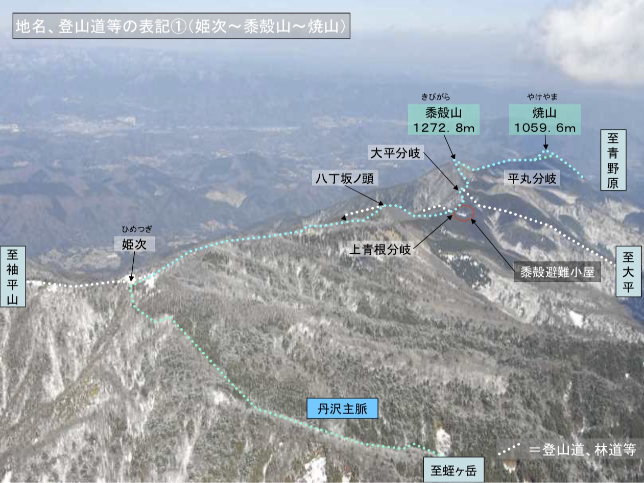 | 1,261 × 946 (272 KB) | T (talk | contribs) |
- You cannot overwrite this file.
File usage
The following page links to this file: