File:L52.6833z39.4250map.jpg
Summary
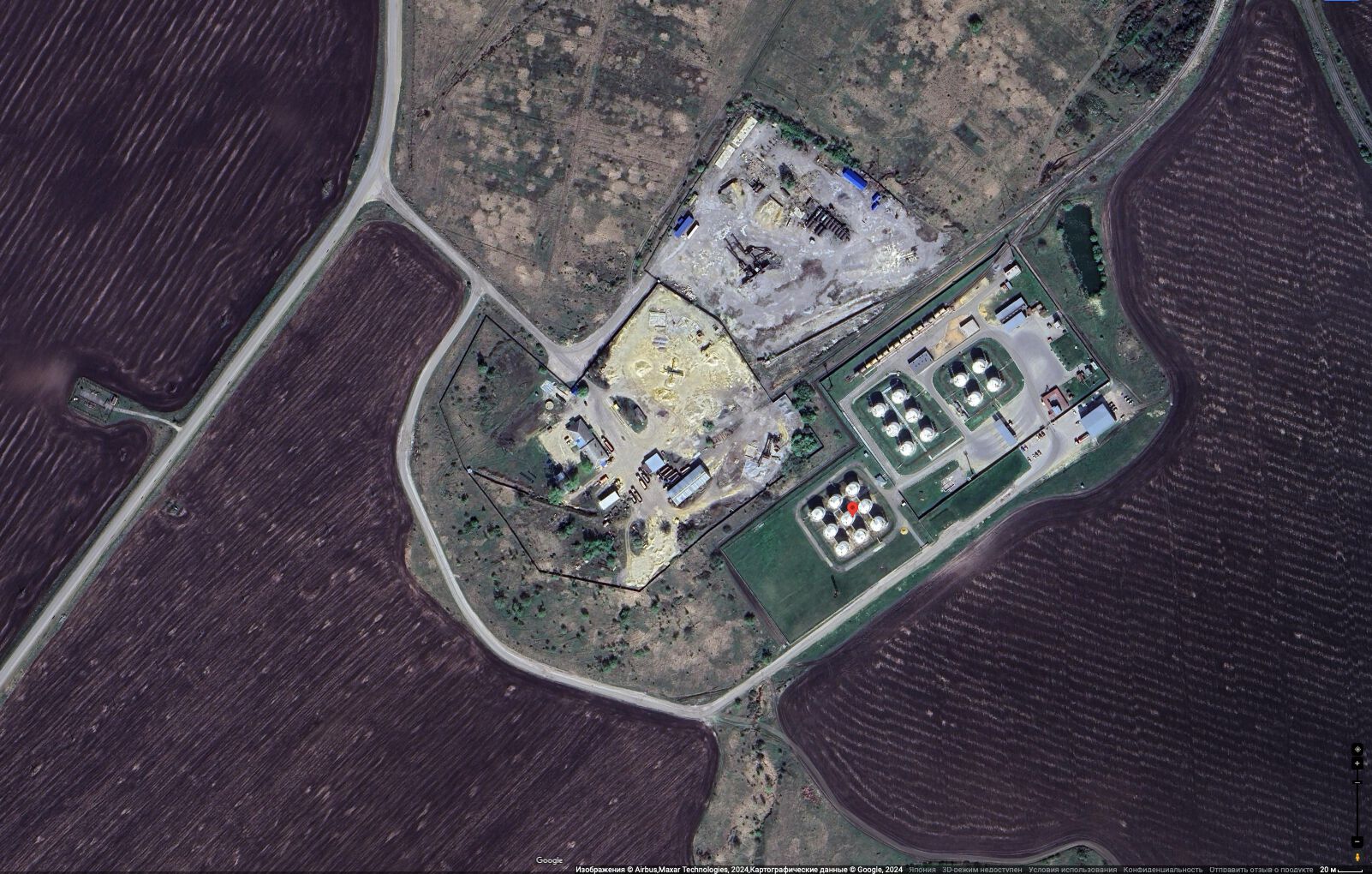
L52.6833z39.4250 at the Google map, view for year 2024
In TORI, term «L52.6833z39.4250» denotes industrial strategic construction in vicinity of point with coordinates
52.6833,39.4250
This object is identified as oil factory and fuel storage.
It will be interesting to compare the pic of this object with similar picture captured after the bavovna,
Such a bavovna is expected to happen duding the Putin world war at the Transfer of hostilities to aggressor territory.
Such a comparison is important for qualification of sources of information and for revealing of propaganda.
References
Keywords
«[[]]», «[[]]», «Annexation of Crimea», «Budapest memorandum», «[[]]», «Demilitarization», «Denazification», «Designate Russia as state sponsor of terrorism», «Designate Russia as terrorist state», «Lipetsk», «Lipetsk Airbase», «L52.6833z39.4250», «Lz», «Moscovia», «Pahanat», «Russki mir», «Transfer of hostilities to aggressor territory»,
«А нас то за что», «Авиабаза Липецк», «Аннексия Крыма», «Бавовна», «Будапештский меморандум», «Вертикаль власти», «[[]]», «Демилитаризация», «Денацификация», «[[]]», «Московия», «Новый Мировой Порядок», «Паханат», «[[]]», «Перенос боевых действий на территорию страны агрессора», «Русский мир»,
File history
Click on a date/time to view the file as it appeared at that time.
| Date/Time | Thumbnail | Dimensions | User | Comment | |
|---|---|---|---|---|---|
| current | 00:50, 12 August 2024 | | 1,602 × 1,020 (372 KB) | T (talk | contribs) | == Summary == {{oq|L52.6833z39.4250map.jpg|}} L52.6833z39.4250 at the Google map, view for year 2024 In TORI, term «L52.6833z39.4250» denotes industrial strategic construction in vicinity of point with coordinates 52.6833,39.4250 This o... |
- You cannot overwrite this file.
File usage
The following page links to this file:
- Airbase
- Annexation of Crimea
- Bavovna
- Budapest memorandum
- Demilitarization
- Denazification
- Designate Russia as state sponsor of terrorism
- Designate Russia as terrorist state
- L52.6833z39.4250
- Lipetsk Airbase
- Moscovia
- Pahanat
- Putin world war
- Russian invasion into Ukraine
- Russki mir
- Target
- Transfer of hostilities to aggressor territory